Google Earth is a fabulous resource! We use it quite a bit at home for all kinds of different things. We recently used it to locate a place to vacation on the East Coast with friends.
I really like to use this site at school for a number of reasons. First of all, I no longer have a globe in my classroom so when I talk about the Arctic and Antarctica, which we have been studying, I have no visual to use with my students. I have a world map, which is flat, hence an additional problem. With Google Earth I can show them the whole world and then focus in on a particular area.
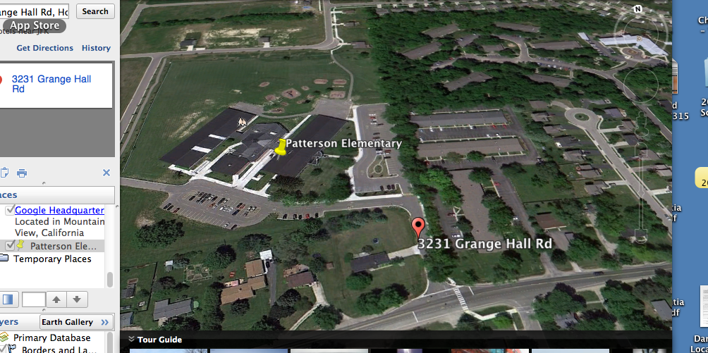
So for this assignment I located our school on Google Earth. I can start with the world, show the United States, show our location in Michigan and then focus in on Holly. Since we work a lot on our community at the lower elementary level I can expose them to where we live but can also scan out and we can look at where things are relative to where we live on the planet. I did try this out this past week with my classroom and the children thought it was pretty cool, especially when I showed them our local McDonalds! (too funny!)
This week I also read my students a book I purchased from the Lynda Locke the author of Thomas the Cat's Adventures. The story starts with Thomas as a small kitten in Canada and then follows him as he moves with his family to Mexico and the friends he meets along the way. I was then able to use Google Earth to show my students where Thomas lived in Canada and then move on to Isla Mujeres Mexico where I was able to get to street level and show them exactly where he lives. I was also able to drive around the island at street level to show them what the rest of the island looks like. Even my para professionals were impressed! Pretty cool!
I really like to use this site at school for a number of reasons. First of all, I no longer have a globe in my classroom so when I talk about the Arctic and Antarctica, which we have been studying, I have no visual to use with my students. I have a world map, which is flat, hence an additional problem. With Google Earth I can show them the whole world and then focus in on a particular area.
So for this assignment I located our school on Google Earth. I can start with the world, show the United States, show our location in Michigan and then focus in on Holly. Since we work a lot on our community at the lower elementary level I can expose them to where we live but can also scan out and we can look at where things are relative to where we live on the planet. I did try this out this past week with my classroom and the children thought it was pretty cool, especially when I showed them our local McDonalds! (too funny!)
This week I also read my students a book I purchased from the Lynda Locke the author of Thomas the Cat's Adventures. The story starts with Thomas as a small kitten in Canada and then follows him as he moves with his family to Mexico and the friends he meets along the way. I was then able to use Google Earth to show my students where Thomas lived in Canada and then move on to Isla Mujeres Mexico where I was able to get to street level and show them exactly where he lives. I was also able to drive around the island at street level to show them what the rest of the island looks like. Even my para professionals were impressed! Pretty cool!
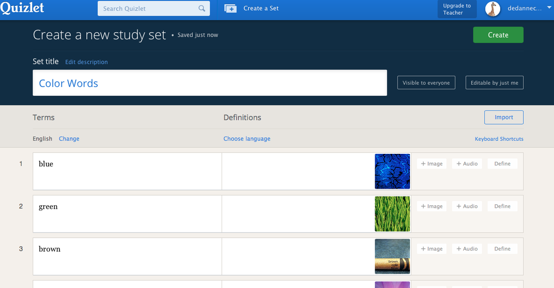
So for Quizlet I put together flashcards for the basic color words. I know it sounds simple and basic, but this is my world! I figure that I can hopefully use this on my iPads with my kiddos as a center. That will be tomorrow's task.
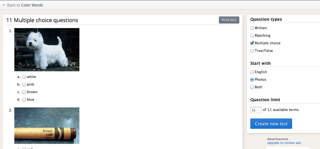
I really like that you can take a set and make it into spelling, or a test or flashcards with different formats for assessments! I tried my basic color words out on a few of my children this past week and they really liked it. Easy to use and implement. http://quizlet.com/69488791/test?mult_choice=on&prompt-with=1&limit=11

 RSS Feed
